An
Examination of
The

New
--An
Enigma Project Report—
by
Michael A. Frizzell
Amongst places of
mystery throughout the world are stories of Gravity Hills. Regardless of their
locations, these odd sites all perform
in basically the same way. Gravity seems out of kilter in these places.
Cars under no power or constraints will drift up these hills—as if propelled by
unseen forces[i]. Upon
analysis, a number of these locations have been shown to be optical illusions
created by unique combinations of angular terrain, location of flora, and
background scenery that trick the eye into perceiving an incline where there is actually a decline.
The Enigma Project has
cataloged a list of over 45 Gravity or Magnetic Hills
in the
- Usually
located on paved roads
- Often
in areas of convoluted terrain
- Visually
perceived as an incline
- The
“effect” is always present (vehicles, balls, et al will roll "up" these hills at all times)
- Death
stigma sometimes attached to area[ii]
Since all
documented gravity hills share some or all of the above traits, and several
have been proven to be illusions, then there is a probability that all gravity
hills are illusions. Having pondered the question over the years, I have
consulted the files and maps of the United States Geological Survey and have
found no reference to any fixed, geophysical phenomenon that could account for
such highly localized areas of apparent
gravitational or magnetic aberration. If we apply the deductive method of
Occam’s Razor (Given two equally predictive theories, choose the simpler), to the choices of, A) Gravity Hills are the sites of
unknown geophysical phenomena or B) Gravity Hills are optical illusions. Given
the available facts, choice B will prevail.
That
being said, are we to assume that there are no such anomalies on the Earth
intense enough to create the phenomena typically mentioned in gravity hill
claims? Given the human propensity for mapping and surveying the planet with
satellites, magnetometers, and other hi-tech gadgets, logic dictates that if
there were such places they would already be matters of scientific record.
Nonetheless, the Earth is a big planet and we certainly haven’t scrutinized
every square meter of it. However unlikely, perhaps somewhere on our globe
there is a place where the laws of geophysics are exaggerated. So, in giving
the Bedford County Gravity Hill the benefit of that doubt, we decided to put
its claims to the test.
Next Stop:
In March of 2004,
when Enigma Project investigator Victor Fulda and I went out in search of the
Bedford County gravity hill, we did not know what to expect in terms of the
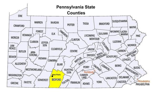
site’s specific location or general appearance (see Figure 1). During our trip
we discovered that this place is not only recognized by the state of
Pennsylvania as a landmark, is has been deemed a tourist attraction by the
Bedford County Bureau of Tourism (see Figure 2)[iii].
 …
…
Figure 1- Pennsylvania’s Counties Figure
2- Bedford Co. Brochure
When we finally
found the spot, set in beautiful rural countryside along Gravity Hill Road[iv],
we were impressed by the apparent grade of the road. At what appeared to
be the bottom of the hill, some past visitor had marked the word “start,” with
white spray paint, across the road in large letters. In a similar fashion,
printed across the asphalt approximately 400 feet up the hill is the word
“end.” Presumably, as a matter of convenience, these designations were added
for the benefit of future visitors to denote where the phenomenon begins and
stops (see Figures 3 & 4).


Figure 3- Gravity Hill “Start” Marker
(looking up the hill) Figure
4- Gravity Hill “End” Marker (looking down the hill)
Our Evaluation of the Road consisted of Two Different
Measurement Tests
The first test
involved using a GPS unit to measure elevation on Gravity Hill Road within the
“start” and “end” window mentioned above[v].
The following elevations were obtained:
Gravity Hill “Start” elevation: 1,582 feet
150 feet “up” Gravity Hill: 1,576
feet
300 feet “up” Gravity Hill: 1,564
feet
Gravity Hill “End” elevation: 1,569
feet
GH length from “Start” to “End” = 416 feet
The values we
measured on Gravity Hill Road from the “start” position, clearly show a drop in
elevation along the way, and a slight increase in elevation at the “end”
marker. The chart below (Figure 5) shows these values as contours that tend to
disagree with what the eye sees.

Figure 5- Elevation
Changes along Gravity Hill
Our second test
consisted of a series of careful measurements taken with a tripod laser level
along the 416 foot length of Gravity Hill (see Figure 6). The objective here
was to determine the amount of change in declination or inclination that
occurred on the hill from beginning to end. This was accomplished by projecting
a leveled, tripod-mounted laser beam as against a large, movable wooden mast
which we proceeded to move up gravity hill. Much like a surveyor’s leveling
rod, the 8 foot tall mast had been carefully graduated in feet and inches so
that measured changes along the road could be resolved in detail (see Figure
7).


Figure 6-
Victor Fulda levels Tripod Mounted Diode Laser Figure
7- Mike Frizzell holds Graduated board for Laser Measurement
The
laser we were using was limited to a projection distance of 100 feet in bright
daylight so we took measurements between the laser and the rod in 100 foot
increments. After several hours of measurement (we had to move our equipment
for passing vehicles and then re-adjust), we obtained enough data points to
render the relative drop in the road’s elevation (see Figure 8).

Figure 8- Laser survey of Gravity Hill
shows unmistakable decline in road
Prior
to our testing of Gravity Hill, we knew that topographic maps of the road
revealed nothing more than a subtle decline (not an incline) in its elevation (see
Figure 9). However, for many people “seeing is believing,” and we anticipated
that some would probably reject the dry values on a topographic map over what
they see with their own eyes. So, in anticipation of that reaction we decided
to “go the extra mile” and demonstrate that this odd strip of road is not some
anomaly in violation of geophysical laws.

Figure 9- “Start” & “End” markers on
road correspond to decreasing elevation levels on topographic map
A Possible History of Bedford
County’s Gravity Hill
As we busied
ourselves with our laser survey of that scenic country road, at one point a car
stopped next to us and the elderly couple inside politely asked what we were
doing. When we explained our reason for being there late on a Sunday morning, the
elderly gentleman smiled and told us he was native to the area and actually
knew the chap that “discovered”
The New Paris Gravity Hill was first
observed by a postman named Charlie Gumppet, just after World War II. During
his delivery rounds one day, Charlie stopped along the old country road (now
known as Gravity Hill Road) to sort his mail. As he sat in his truck performing
this task, he placed the vehicle in neutral and slipped his foot off the brake.
He soon became distracted from his chore, when his truck slowly began drifting
uphill—apparently against gravity. By the mid-1950s, Charlie retired from the
Postal Service and began raising produce on a nearby farm at the end of
There’s Nothing Up Our Sleeves
As
mentioned in the first paragraph of this report, all of the gravity hills put
to the test have been shown to be optical illusions. Conditions of local
terrain, the sway of trees, the curves of background scenery have all blended
to trick the eye. As a final evaluation of Gravity Hill we took identical
photos of a view “up” the road from the “start” position. The first photo is
intact. The second photo has had all peripheral scenery removed. Figure 11
suggests an incline. Does Figure 12 agree??
Look carefully…


Figure 11- Normal
Gravity Hill road view Figure
12- Gravity Hill road view with optical bias removed
Geophysical Anomalies—Yes or No ?
Since Gravity Hills are probably not perversions of
physics, do Anomalies of Gravity & Magnetism Exist on Earth?
Yes! They most definitely do. However, this answer
must be qualified.
If
you know what to ask for you can actually find official US Geological Survey
maps with such intriguing titles as the Magnetic Intensity Map, the Bouguer Gravity
Anomaly Map and the Magnetic Anomaly Map[vii].
Such labels might be interpreted as meaning that Gravity and Magnetic Hills
have already been detected and recorded. Actually, these maps cover most of the
General Location of the Bedford
County-New
Pennsylvania, Bedford County,
~ 1 mile southwest of New Paris, PA off
Rt. 96 (Cortland Rd.) to Bethel Hollow Road (SR 4016) and along Gravity
Hill Road (T 539) (watch for white “start” & “end” markers on road)(see
Figure 10).
Specific GPS location WPT001 (“Start”):
N40°06.678’
W78°41.571’

Figure 10- General Map showing Route to
Gravity Hill (“Start”) from
While
some of these odd places have been subjected to close examination, others have
not. Should you learn of a gravity or magnetic hill in your area and wish to
evaluate it, your first course of action should be to check a topographic map
of the location[x]. This
type of map may easily dispel the gravity hill claims by revealing terrain
measurements that flatly contradict what the naked eye perceives. There are
even websites that offer free topographic information online[xi].
However, if you cannot resolve the mystery with a topographic map, a simple GPS
survey of the site (as we’ve shown above) should settle the matter.
Most unexplained phenomena are uncooperative and frustratingly transient. UFOs accelerate to warp 10, Ghosts vanish, and Bigfoot runs away. Gravity hills, however, are firmly anchored. They remain on-demand and readily avail themselves to analysis. If they are not all illusions, they will patiently wait until someone proves it.
Please bear in mind that many
of the sites we’ve referred to are located on active roadways. Trying to
experience a gravity hill with your vehicle or taking measurements on foot
might be extremely hazardous due to moving traffic. Please use common sense,
apply all due caution, and obey local laws in these situations.
We invite the input of readers concerning their
experiences with this and other Gravity Hills.
The Enigma Project
Email: director@enigmaproject.org